
Environmental impact assessments (EIA) are important for analyzing how proposed projects may affect areas around them. Below is a look into a sample EIA about a proposed ski development in Squamish, BC.
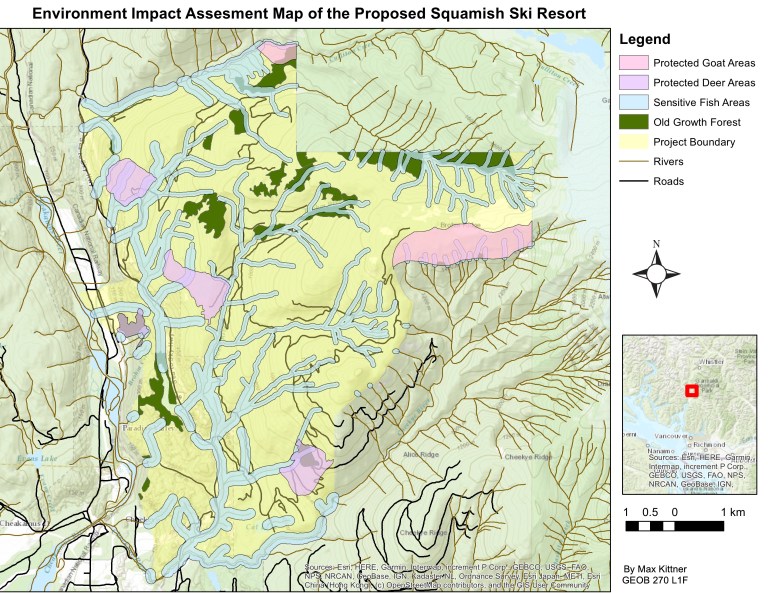
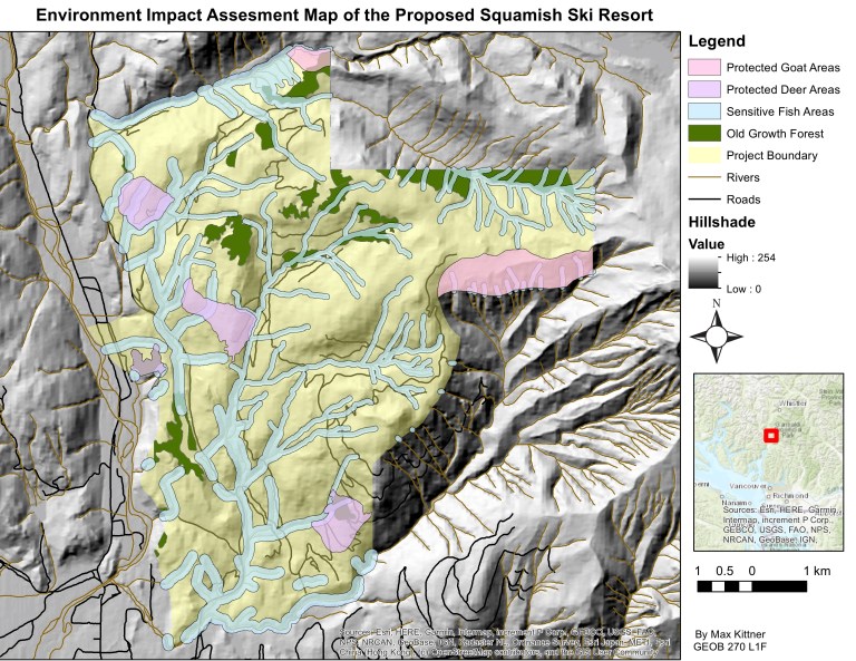
The Squamish area proposed ski development is set on a very complex site that involves many different external factors that may affect the viability of the development. The environmental impact assessment denotes a project site that may be impacted by elevation, protected lands for animals, old-growth forests and protected areas for fish. These different areas could impact how large the development could be, as well as possibly make the development plans adjust to protected lands.
The general results found that there was a sizable amount of protected areas within the project boundary. This could be a problem for developers who want to have easy access to as much of the land as possible in order to make an expansive site. As well there is a problem where a chunk of the land (30.8%) is below a stable snow line of 600 metres. This could further constrain land usage for the proposed development.
The percentage of proposed areas that are protected is about 40.78% in total. This breaks down with overlapping claims of protected fish habitats (30.6%), mule deer and goat areas (7.88%) and old-growth forests (6.78%). This will have to be factored into place with the fact that only about 68.2% of the land is within the proposed snow line.
Some sources of error may stem from the compilation of data from various sources. This can make it hard to make sure the information is recorded exactly the same when there are a lot of layers involved. As well, Environmental Impact Assessments are best used when the data is most up to date, and some of these layers have been updated more recently than others. It would also be important to have a consultation with First Nations communities and understanding lands that may be of importance to them before proceeding further on the development.
In Summary:
- I compiled data from open data portals and synthesized the data within the project areas.
- I was able to join layers, intersect and filter information to best showcase where protected and unprotected lands are in the project area outside of Squamish.
- I learned to display rasters and DEMs in 3D, to showcase elevation.
